Hey! This site is reader-supported and we earn commissions if you purchase products from retailers after clicking on a link from our site.
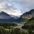
Sun-drenched plateaus. Intense colors upon sandstone rock formations. Impossibly deep canyons. Grand Staircase Escalante National Monument is an incredibly beautiful and remote landscape with so much to see. You won’t believe your eyes when you arrive at your first trailhead. If you are pining for a hike or several, then it’s time to tie up your hiking boots and head to Grand Staircase Escalante.
We have a list of what to do at Grand Staircase Escalante, Utah to help you flesh out the ultimate itinerary, no matter how much time you have to explore. Let’s get started.
About Grand Staircase Escalante
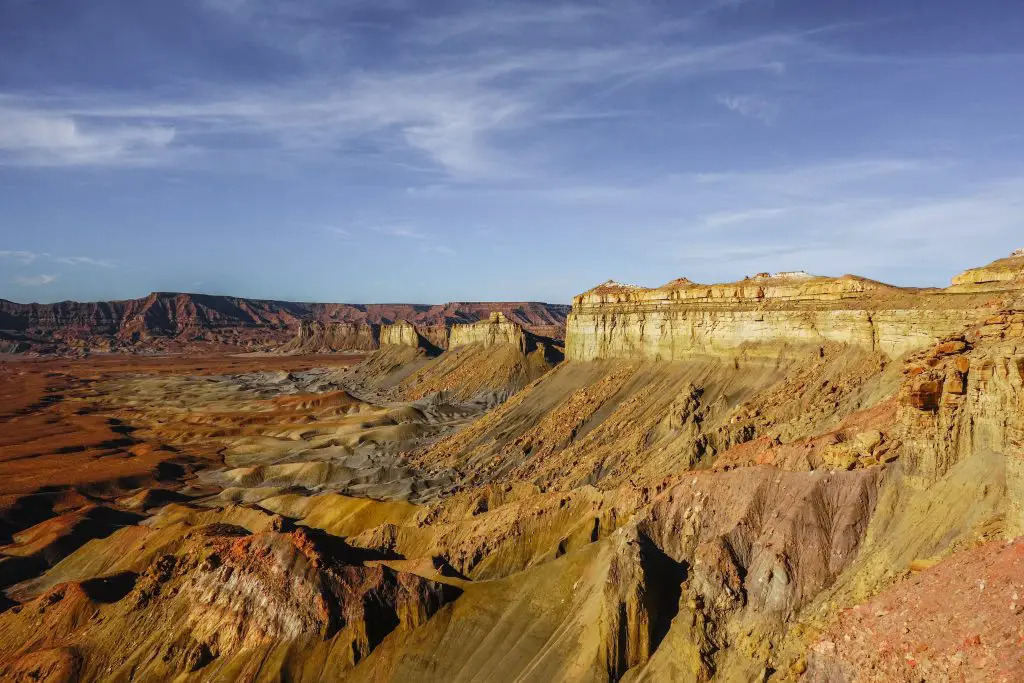
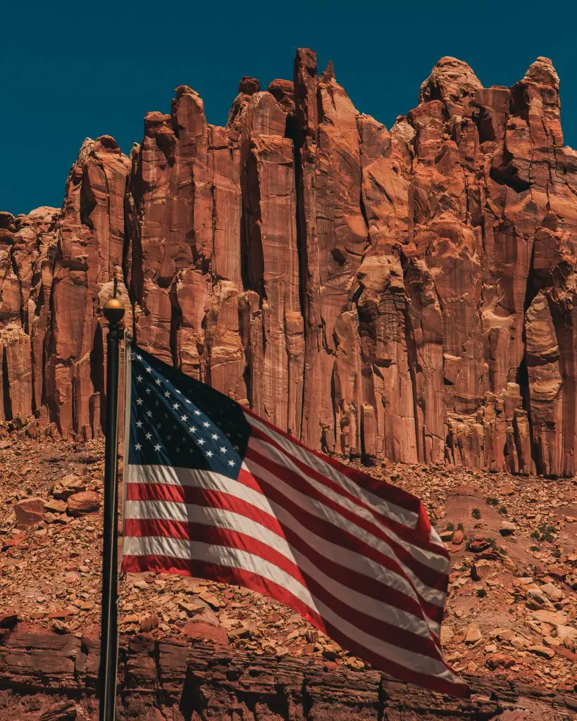
Spanning across 1.87 million acres of Utah backcountry is the Grand Staircase Escalante National Monument. The region is full of brightly colored sandstone, terraces and cliffs, the Kaiparowits Plateau, canyons, natural bridges, and much more. Due to the rugged landscape, the region known as Grand Staircase Escalante National Monument was one of the last places within the contiguous states to be mapped.
The Grand Staircase Escalante is also amazingly diverse, for it spans forests of pine trees and desert. Within this sprawling region, the Fremont and Anasazi people found one another around AD 950-1100 and started making campsites, rock art, and granaries that have been unearthed. Furthermore, studying fossils from this region have given scientists one of the most accurate depictions of the end of the dinosaurs’ reign.
There are three sections of the Grand Staircase Escalante National Monument: the Escalante Canyons, Kaiparowits, and Grand Staircase.
The Escalante Canyon is the most visited region of the national monument. Hikers come to this area to see the canyons, oases, natural bridges and arches, and waterfalls. The Kaiparowits Plateau separates Escalante Canyon from Grand Staircase. Throughout the plateau, the sedimentary rock keep an impressive history of the planet that goes back 30 million years.
On the opposite end of the national monument is the remote Grand Staircase area. Here, you can find a vast and complex network of canyons. The region can be difficult to traverse, particularly due to only a few trailheads connecting to paved roads.
On September 18, 2021, the Grand Staircase Escalante National Monument celebrated the 25th anniversary of its foundation.
What to Know About Grand Staircase Escalante Before You Go
Before you go check out all the things to do in Grand Staircase Escalante National Monument, you need to be prepared. If you plan on visiting the backcountry, you are going to need enough water, meaning one gallon (4L) of water for every person in your group. Make sure you have at least a gallon for every day you’re visiting the area. For instance, if you’re visiting for 3 days, you’re going to need 3 gallons for one person, or 9-10 gallons for a group of 3.
You also need things like sunscreen, UV-reflective or resistant clothing, a hat, and decent hiking shoes. During the summer, temperatures can easily soar about 100F/38C. In the winter, the temperatures rapidly drop to below freezing.
But the most difficult thing? The unpredictable, heavy rains that make many of the roads impassable, even if you’re driving a high-clearance, four-wheel drive SUV or Jeep.
How to Get to Grand Staircase Escalante National Monument
The national monument can be found on the southern edge of Utah, between Garfield and Kane counties. There are a couple towns on the outskirts of Grand Staircase Escalante where you can find accommodations and entrances to the area, which include:
- Big Water
- Kanab
- Escalante
- Boulder
- Cannonville
- Tropic
- Henrieville
Stemming from these towns are the two main roads that cut through Grand Staircase Escalante National Monument. From the northern side, you can take Scenic Byway 12. Coming from the south? Hop on Highway 89. Most of the places and things to do in Grand Staircase Escalante can be found off Scenic Byway 12 and Highway 89.
What to do at Grand Staircase Escalante National Monument
You might be wondering what to do at Grand Staircase Escalante. The answer is to go on an adventure. While there might not be a slew of activities that you can do in this protected place, there are a lot of sights to see and hiking to be done. As long as you’re prepared to take a drive, you’re ready to see the magic of the Grand Staircase Escalante region.
Here is exactly what to do at Grand Staircase Escalante National Monument for the best time ever:
1. Drive up to Grosvenor Arch
Near the western edge of the national monument, you will see a sandstone rock formation known as the Grosvenor Arch. The arch is named in honor of Gilbert Hovey Grosvenor, the publisher of National Geographic magazine and president of the National Geographic Society. It’s an amazing work of natural art, and it’s definitely a great place to kick off your trip to Grand Staircase Escalante.

The arch can be found along State Route 12, about 9 miles south of Kodachrome Basin State Park (which isn’t part of Grand Staircase Escalante). You will need a 4WD vehicle to get across the 10 dusty miles of Cottonwood Canyon Road. Because the road can become inaccessible during inclement weather, it’s best to visit between March and November.
Once you reach Grosvenor Arch, there is an ADA-accessible concrete sidewalk. Dogs are also allowed in this area, but you have to keep them on a leash, And if you’re looking for a restroom, toilets are available near the parking lot.
2. Set up Camp at the Calf Creek Recreation Area
Looking for a place to set up camp for your trip to Grand Staircase Escalante? The Calf Creek Recreation Area can be found between Boulder and Escalante on Scenic Byway 12. There are 13 campsites here, as well as a picnic area, and the trailhead to Lower Calf Creek Falls.
Near the Calf Creek Recreation Area, between mile markers 80 and 81 on Scenic Byway 12, you will find an unmarked trailhead leading to a canyon. The hike is short, about 2 miles in length, but it takes 2 hours to complete. You spend almost the whole hike going uphill through the canyon. Since this is a strenuous and secluded trek, most visitors miss it. However, while you’re camping, you can easily find it and have the whole trail to yourself.
3. Hike to Lower Calf Creek Falls
The Lower Calf Creek Falls is one of the best things to do in Grand Staircase Escalante, because the payoff for your hike is immense. The hike is about 3 miles in one direction, taking you along rugged terrain and through a lot of shifting sand. Most of the walk here is going to be hot, but once you get close to the waterfalls—the sound resonates through the area before you see it—the air temperature drops and you feel immediate relief.
The sight of the waterfall from Lower Calf Creek plummeting 126 feet into a pool below is marvelous. On the hotter days, it is not uncommon to see hikers and their dog companions playing around in the refreshing waters.
Although the trail has only a slight elevation gain, there are a few rocky cliffs to look out for. It’s a moderately difficult trail, so it might not be the best for children. In total, it’s 6.7 miles and takes 3-4 hours to finish. It’s recommended that you get here early in the morning, since the parking lot can get congested.
4. Find the Toadstools
The Toadstools don’t look like they could have been crafted by nature, but they are. Toadstools are formed when soft rock on the outside starts to erode from wind and rain, leaving a column behind. These balanced rock formations are seen through the Grand Staircase Escalante National Monument, meaning that one of the reasons to visit is to see them.
You can take the The Toadstools trail to see dozens. In about 1.5 miles of easy walking, you see impressive formations that will have your jaw dropping. At the edge of the Paria River, the most incredible toadstools await.
5. Visit the Escalante Region
As mentioned earlier, there are three distinct sections to Grand Staircase Escalante National Monument. The Escalante area is full of attractions and hikes for you to choose from. Some of them can’t be missed, including the Devil’s Garden (also known as Devil’s Rock Garden). The Devil’s Garden covers about 640 acres and is a stunning expanse of hoodoos, arches, canyons, and domes. You can take the 1 mile loop through the rocks or take a break around the picnic area.
There are two other places that you have to stop in the Escalante: the Escalante Petrified Forest State Park and the Escalante River Trail.
Escalante Petrified Forest State Park is located near the town of Escalante. You can see petrified trees from ancient times and take a walk along short but scenic pathways. At the Wide Hollow Reservoir within the park, you can launch canoes, kayaks, and paddleboards. This isn’t located within the national monument, but it’s definitely a worthwhile stop.
Next, you have the Escalante River Trail, a 6.1 mile long track available from May to October. Found along the Escalante River, this trail features the Escalante Natural Bridge and Escalante Natural Arch. Both are found at the middle of the trail. If you don’t want to cross the river, you can turn around once you see the stone formations.
6. Find the Wahweap Hoodoos
Once you have seen the Toadstools, you might be wondering what to do in Grand Staircase Escalante next. It’s time to seek out the Wahweap Hoodoos. You probably already know that Bryce Canyon is famous for hoodoos, but Grand Staircase Escalante also has them. If you are visiting for a full day, you should seek out this less conventional hike.
Travel down Highway 89 towards Big Water. Once you reach the town, head north along Nipple Canyon/Fish Hatchery Rd. You will cross a creek and eventually come to the Wahweap Hoodoos trailhead. Since the road is unpaved, you will need an appropriate vehicle to get there.
Park at the trailhead then walk north along the riverbed. The first thing you will see is the White Ghost Hoodoo, which rises high above smaller red pinnacles and other rock formations.
7. Hike Wire Pass to Buckskin Gulch
In order to do this hike, you need to drive about 45 miles to get to the trailhead, purchase a $6 permit (and one for your little dog, too), and then put a form on the dashboard of your vehicle. It is possible to purchase the permit ahead of time or at the trailhead if your signal is strong enough.
The hike takes a little while to complete, because you are navigating around rocks (boulder jams) and other obstacles. About 3.4 miles roundtrip, the hike takes about 2 hours to complete and is considered easy, so you can bring the kids along.
The Wire Pass trailhead is popular because it is the most direct and least challenging way into Buckskin Gulch. What makes Buckskin Gulch so famous? It’s 12.5 miles of canyons, where some points are 100-200 feet deep. Navajo sandstone makes up the towering walls.
8. Wriggle Along the Peek-a-Boo and Spooky Slot Canyon Hike
Looking for another slot canyon hike after experiencing Buckskin Gulch? Both Peek-a-Boo and Spooky slot canyons are a worthwhile adventure for the whole group. It can look a bit intimidating when you first begin, as you have to climb into the canyon then shimmy through narrow spaces.
Children and adults alike can navigate the slot canyons, though some of the gaps will require some support from a friend or a sucked-in stomach. It’s recommended that you leave the backpack behind.
Once you come out of the first two canyons, you can call it a day, as all the climbing is exhausting, or you can try Spider canyon, another slot canyon. Some of the crevices in Spider Canyon are challenging, but you will have warmed up in the other two.
Getting to the trailhead requires the drive along Hole-in-the-Rock road, as well as a short half mile hike. Once you’re ready to leave, you need to go up the trailhead to reach the parking lot.
9. Visit The Hole-In-The-Rock Road
If you have a good 4-wheel-drive vehicle, then there is one drive you cannot pass up—the 55-mile long Hole-in-the-Rock road. Located south of Highway 12, this road was constructed by Mormon settlers in 1879. While you can survive in a 2WD car for the first half of the road, the conditions soon become very bumpy and rough, so a 4×4 is necessary to complete the full course.
Also, if you see even one cloud in the sky, you should avoid this road. Rain and snow make the conditions considerably worse, and you don’t want to get trapped in the rain in the middle of nowhere.
The first 12 miles take you to Devil’s Garden. Further in, you will find trailheads for the Coyote Gulch trailhead, as well as the Spooky and Peek-a-Boo slot canyons. Further out, you will find the place where the Mormon settlers blasted through red rock to reach the river. Now, it forms Lake Powell.
Overall, it’s a fun and historical drive that leads you through a lot of amazing scenery. You can use this road to get to trails, or you can make the drive solely for the purpose of seeing the beautiful lake.
10. Take a Drive Along Scenic Byway 12
This one is probably obvious, but you should underestimate how beautiful the world can be from the car window. Scenic Byway 12 is called an All American Road for a reason. Spanning over 120 miles in length, this road gives you a complete tour of the national monument. As you drive, the background changes for red stone canyons, pinkish-orange slickrock, and distant white-capped mesas.
Even if you don’t plan on exploring the depths of Grand Staircase Escalante, driving the Scenic Byway 12 shouldn’t be passed up. You pass entrances to other amazing national parks, including Capitol Reef and Bryce Canyon. Quaint western towns, a 9,000-foot tall peak, and other attractions line Scenic Byway 12.
You can also take advantage of the overlooks dotting the roadway. Bring your camera and snap shot after shot of the vistas, the mesas, and the sprawling red rocks of Grand Staircase Escalante and Capitol Reef converge.
Time to Visit Grand Staircase Escalante!
There are so many things to do in Grand Staircase Escalante that our list barely touches the surface. That said, these options should give you a great idea about where to start. Once you have arrived at Grand Staircase Escalante National Monument, your adventure will unfold! Which trail are you going to dive into first?
FAQs
1. Is it worth visiting Grand Staircase Escalante?
If you love the Great Outdoors, then you are going to find Grand Staircase Escalante to be a massive playground that you will want to return to again and again.
2. How much time do you need at Grand Staircase Escalante?
If you don’t have a lot of time to see Grand Staircase Escalante National Monument, then you can drive along Scenic Byway 12 or Highway 89 in a day. During that drive, you can do a few easier hikes that don’t take much time. Then you’ll be through the area and able to continue on.
3. Can you drive through Grand Staircase Escalante?
If you want to drive along the borders of Grand Staircase Escalante, you can take Scenic Byway 12 (which spans 120 miles of the area), which comes from the northern edge of the region before skirting westward. If you are coming from the south, Highway 89 does move through the bottom portion of the national monument for several miles.
4. Is Grand Staircase Escalante free?
The only trail that requires a paid permit to enter is Wire Pass to Buckskin Gulch.